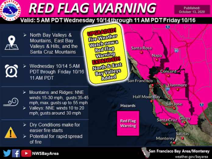
A Fire Weather Watch that was issued from the National Weather Service (NWS) on Oct. 12 has been upgraded to a Red Flag Warning. The warning spans throughout coastal and inland parts of California, covering the North Bay valleys and mountains, East Bay valleys and hills and the Santa Cruz mountains. The warning will be in effect from 5 a.m. this Wednesday, Oct. 14 to 11 a.m. on Friday, Oct. 16.
Mountains and ridges are predicted to have north and northeast winds at between 15 and 30 miles per hour, with gusts at 35 to 45 miles per hour and maximum gusts at 55 miles per hour. Valleys are predicted to have north and northeast winds at 10 to 20 miles per hour, with gusts around 30 miles per hour.
Day time humidity in the area is expected to drop to 10% to 20% with little nighttime recovery.
Dry conditions in the area will make it easier for fires to start, and winds can pave the way for more rapid fire spread.
According to NWS, winds are expected to begin increasing early Wednesday morning, with gustier winds developing in the hills Wednesday evening and peaking overnight and into Thursday morning. Winds will likely increase Thursday evening, though not as strong.
A Fire Weather Watch and subsequent Red Flag Warning were issued two weeks ago, from Sept. 30 to Oct. 3. The week before that, a Fire Weather Watch and Red Flag Warning were issued for Sept. 26 to Sept. 28 — during which the Glass Fire started.
Concurrent with, and due to, the Red Flag Warning, Pacific Gas & Electric company (PG&E) has announced a Public Safety Power Shutoff “Outage Watch” for the same time period. An Outage Watch indicates that shutoffs are likely. To check your address for possible impacts or to see a map of possible affected areas, go to https://pgealerts.alerts.pge.com/updates/.


