In case you haven’t noticed, it’s been raining. Hard. So hard, that all sorts of flooding, mudsliding and other havoc has unfolded across Healdsburg and environs over the past four days.
In the time since a “bomb cyclone” mated with an “atmospheric river” and started unleashing its waters on Healdsburg in the wee hours Wednesday morning, we’ve gotten around 16 inches of rain in town and up to 22 inches in the hills west of town, according to our local office of the National Weather Service — much more rain than originally predicted. This deluge has shattered multiple daily rainfall records at the Sonoma County Airport in northern Santa Rosa (the closest spot to Healdsburg where they keep these kinds of historical records, as far as I can tell), and has amounted to monthly rain totals about three times the norm for November, weather officials say. We’ve now gotten more than half our average rainfall for the entire year, in a matter of days.
Here’s what the storm looked like from space, with radar showing the “total precipitable water” in the atmosphere:
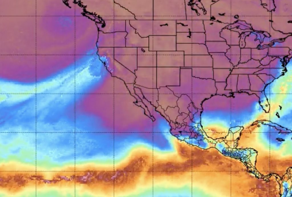
And here’s what this “plume of increased moisture” meant on the ground in Healdsburg, in order of occurrence:
- After 24 hours of relentless rain and wind, our low-lying streets, lots and pathways started flooding on Thursday morning. In particular, those in close proximity to Foss Creek, which jumped its banks and inundated the surrounding area. By early afternoon, one neighbor posted pics on Facebook of their dog peering out over the fully flooded Foss Creek Pathway near the skate park, which looked more like a lake at that point. Throughout the day, city officials closed Grove Street from Foss Creek Circle to North Street, North from Grove to the freeway, Larkspur Drive from Grant Street to Marigold Way and Allan Court and Moore Lane behind City Hall. (Parts of Parkland Farms, too.) Water was creeping into wheel wells, so the traffic signs went up.
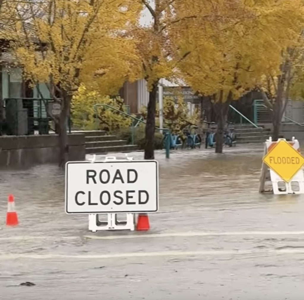
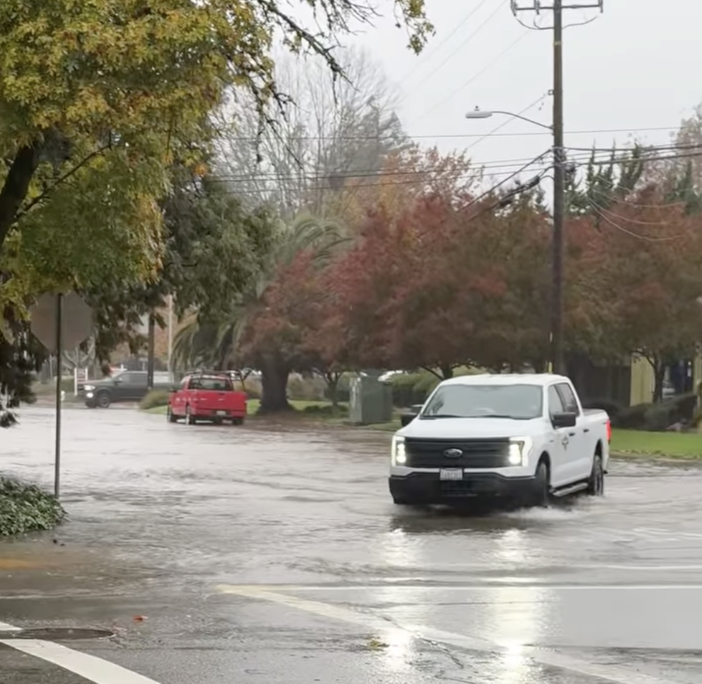
- Elsewhere in town, at least one resident reported severe flood damage to their home on Thursday. A woman who lives near 7 Eleven on Healdsburg Avenue posted photos of the devastation in the “What’s Happening Healdsburg” Facebook Group. She wrote: “We’ve been here for years and have never seen anything like this. This all happened within 1.5 hours. Checked downstairs at 10:30 then by 12:00 we had no time to do anything. We had pumps and sand bags. With the pumps, we had no where to put the hose because the water was surrounding our whole entire house.”
- That same afternoon, Press Democrat photographer Kent Porter took a crazy photo of Healdsburg resident Vanessa Maclure wading through West North Street floodwaters while clutching her little dog Kirby. She had just picked the dog up from the groomer, the PD reported, and “flash flooding prevented her from driving a vehicle down the flooded roadway.”
- Come early Friday morning, a waterlogged chunk of Fitch Mountain mud had broken loose and slid down into the road, along Madrone Avenue. The mudslide “sent debris tumbling onto a Healdsburg property, prompting officials to quickly cordon off the area,” the Press Democrat reported. “By 11:30 a.m., public works crews were on-site, evaluating the extent of the damage and planning their next steps.”
- Also on Friday, at least one driver had to be rescued from that notorious network of rural roads just south of Healdsburg and east of Windsor, near Mark West Creek, known for quickly flooding whenever the rain really starts coming down. A scary Press Democrat photo showed Leticia Lezama sitting in her disabled car as crews worked to rescue her from floodwaters on Slusser Road. A mom from Ukiah actually died around there in another rainstorm two years back, after getting trapped in her car on nearby Trenton-Healdsburg Road. Different outcome this time, luckily…
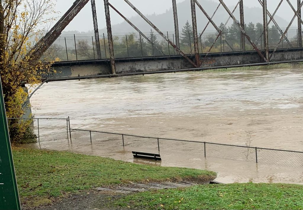
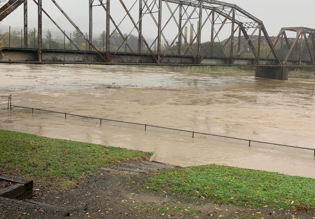
- The Russian River kept rising rapidly throughout the storm, of course. By Friday afternoon, it had surged passed flood level at Digger’s Bend, one of the two spots where officials measure it in Healdsburg — peaking around 3pm at just over 30 feet. And at the other measuring spot downstream, near Badger Park, the 3pm peak was 20 feet (just shy of the official danger zone). Now, nearly 24 hours later, river levels near Digger’s and Badger are back down to around 22 feet and 15 feet, respectively, and still dropping steadily as we speak.


- Other parts of Sonoma County got hit even worse by this historic storm. Multiple schools in south and west county sent students home and closed their doors; dozens of roads were closed due to floodwaters, landslides and fallen trees; firefighters saved a lady stuck in a flooded Santa Rosa culvert, among other water rescues; hundreds of people saw their power go out; hundreds more got trapped at Sutter Health and the next-door Hampton Inn in Santa Rosa due to rising waters on surrounding streets; and the Russian River did end up flooding in Guerneville, where the Johnson’s Beach sign was barely visible and where the KRON4 news station spotted “several vehicles and buildings… submerged in several feet of water.” Government maps show the river is peaking in Guerneville as we speak, and should sink back down below flood levels by Sunday morning.
I think that about sums it up. If you have any additional stories or photos about the Great Rainstorm of November 2024, consider sending ’em my way so I can share with the community.
Quick flashback, for some climate contrast: It was only a month-and-a-half ago that a San Francisco Chronicle photojournalist came to Healdsburg and documented all of us grappling with near-record triple-digit heat in early autumn. “A scorching sun soared above Healdsburg on Tuesday, paying no heed to the arrival of October, as day laborers and day trippers alike confronted a brutal heat wave,” the Chronicle reported at the time. “Workers waiting for jobs hovered in the shade before 10 a.m. as if it were still July. A panhandler perched on a roadside median strip shaded his face with a piece of cardboard. A shirtless toddler climbed out of a minivan at a Russian River park.”
Kinda spooky, right? Now, looking ahead: While there is still some light rain in the forecast over the next week, meteorologists are only predicting around an inch more sky water to accumulate through next Friday. The sun’s rays are finally reaching Earth this afternoon, and all those flood alerts have expired. So the chaos should only subside from here. In the short term, at least!




Great article and photos. Well Done!