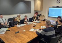
At the third of four required formal public hearings regarding the Town of Windsor’s redistricting process, which began in September of last year, the Windsor Town Council selected a final map at their March 2 meeting.
Consultants originally suggested three maps at the Jan. 24 meeting, but council members asked them to return to the drawing board, and they brought six additional maps to Wednesday’s meeting. At the start of the hearing, BBK representative Todd Leishman asked council members to identify which of the nine map options they preferred. Vice Mayor Esther Lemus and District 3 Councilmember Debora Fudge suggested Map 9, Councilmember Rosa Reynoza suggested Map 4 and Mayor Sam Salmon suggested Maps 2, 4 and 9.
Ultimately, consensus was achieved on Map 9, created by a member of the public, with council members — and consultants — eager to get the process complete ahead of the deadline.
“I’d like to honor a member of the public by choosing one of their maps,” District 3 Councilmember Debora Fudge said, a sentiment shared by the rest of the council, who have been less-than-satisfied with the map options presented during the process. However, the map was selected mostly because it kept certain areas whole, such as Vintage Greens and the Vintana neighborhood and the downtown area, while absorbing southeast Windsor in District 3, rather than leaving the area to continue as part of District 4 — where residents said they felt dissimilar to the other residents.
Map Option 9 has District 1 lose an area south of Windsor River Road surrounding Keiser Park to District 4, while gaining a triangular area south of Windsor River Road, going west from the railroad tracks until it meets Windsor Creek. The eastern border of District 1crosses Highway 101 into what’s currently District 2, ending where Cordelia Lane meets Old Redwood Highway and going north along Jane Drive and Camelot Way.
District 2 gains an area south of Vinecrest Road, east of Hembree Lane and north of Jensen Lane, with some minor changes near where Districts 2 and 3 meet along Old Redwood Highway. District 4 will also gain the Bluebird neighborhood just east of Highway 101. District 3, which took up a large part of the discussion because of council members’ desire to keep neighborhoods located near the site of the Koi Nation’s proposed casino together in one district.
The casino, which could have numerous and severe impacts on the area, defines the area as a community of interest, would be constructed legitimately through a federal process defined in the Indian Gaming Rights Act (IGRA) and overseen by the Bureau of Indian Affairs and the U.S. Congress — without needing local government officials’ consent. Local town, county and state officials have expressed opposition to the casino project.
Similarly, neighbors in the area have expressed a desire to leave District 4, as they do not feel as connected to those living in south Windsor on the west side of Highway 101.
“Map 9 is a mashup of Maps 2 and 3, so it seemed like a compromise, but it is awkward like some of the rest. Nine keeps the downtown area in a way the current map and Map 4. It keeps Vintana and Vintage Greens together, while some other maps split Vintage Greens from Vintana. Nobody every spoke up from those two neighborhoods, but they were built at the same time so you’d think they’d want to be united as much as possible in terms of a district,” Fudge said.
Vice Mayor Lemus also liked that Map Option 9 seemed to compromise, as she said it requires many neighborhoods to give up small portions to balance population, rather than leaving a smaller number to take larger hits.
“I like having every neighborhood give some, rather than have one neighborhood sacrifice and be divided,” Lemus said. “They took every neighborhood that wanted to stay intact ‘give in’ a little. It’s not a perfect process. I don’t really favor any of these maps because they all inevitably impact some neighborhoods, but I like the concept behind this one, and it does manage to keep some neighborhoods together.”
Because this is an imperfect process required by law, certain ideals, such as Mayor Sam Salmon’s wish that Windsor’s districts be divided into four quarters divided neatly by Windsor River Road and Highway 101 had to be done away with.
Councilmember Reynoza, who, alongside Salmon, favored Map 4, said she actually opposed the idea of dividing Windsor into northeast, northwest, southeast and southwest quarters, and said her desire for Map 4 was because, like Map 9, it keeps the neighborhoods affected by the casino whole.
“We want to honor the people of Shiloh Road who want to belong together in one district,” Reynoza said. “That was a big deciding factor. I had to make sure I chose a map that was going to keep that area in District 3.” Reynoza said she was fine with Map 9, despite issues with some of the border in certain parts of town, however, she said no residents in the areas she was concerned about spoke up.
Still, council members had to accept that the process is imperfect, and a map must be selected by the April 7 deadline, or else the Town of Windsor could lose local control over the process.
State and federal law require that California cities redraw districts every 10 years following the release of U.S. Census data, to ensure populations are balanced between districts. Districts are required to have no more than 10% combined deviation from the ideal district, found by dividing the town’s total population by the number of districts (6,594 in Windsor), and, although Windsor’s districts were drawn in 2019 and have been used only once (to elect District 3 Councilmember Debora Fudge and former at-large mayor Dominic Foppoli in 2020), the former district map had a combined total deviation of 18.69% when considering recently released U.S. Census data, as it had been drawn with nine-year-old data from the 2010 U.S. Census. Map Option 9 has a combined deviation of 6.63%, well within the acceptable range.
Windsor switched to a by-district system with an at-large mayor in 2019, following a 2018 lawsuit that alleged the former at-large system marginalized Hispanic voters in violation of the California Voting Rights Act (CVRA) — a common trend facing California cities in recent years. An October 2021 study confirmed that the former system did marginalize Hispanic voters, and that the switch to district elections was the right call, legally speaking.
District elections systems, in theory, are meant to prevent majority ethnic groups from effectively disenfranchising minority populations by out-voting them for each and every council seat. A district system is meant to allow for majority-minority districts in which voters of the smaller ethnic group are the majority and can select at least one councilmember themselves, without their votes being drowned out by the majority ethinc group. In Windsor, this means that the town council would have had to draw a district whose population of eligible Hispanic voters exceeded that of white people.
As this was not possible, the main focus of the redistricting process has been to balance population, although various iterations of District 1 in the north west of Windsor included a Hispanic majority when considering total population and not just the population of eligible voters.
“Creating majority-minority voting districts isn’t really possible based on the demographic makeup of the community. There’s a pretty even spread. The punchline here is that the current district boundaries need to be adjusted to balance the population,” consultant Todd Leishman said.
The agenda report makes no note of whether Map Option 9 included a Hispanic majority (by total population) in District 1. Regardless, the town is not in violation of state or federal law without one, according to consultants. Other considerations include keeping communities of interest — like the neighborhoods near the casino — and neighborhoods as whole as possible, while ensuring districts are contiguous, not subject to racial or political gerrymandering and that they incorporate geographical and topographical factors.
Leishman also said council members could not legally consider how changes would affect themselves, with some necessarily messy results such as in current District 4 being absorbed into District 3 and not being able to vote until 2024. Despite warnings from staff and consultants, talk about these issues did arise, however, it was not a serious or integral part of the discussion.
The March 2 meeting served as the first reading of an ordinance to adopt the selected map, and that map will likely become the official new district map for the Town of Windsor at the March 16 meeting.
Mayor Salmon said that it was possible certain communities who aren’t as “well-read and well-spoken” as the affluent Esposti Park neighborhood may speak up before the second reading.
Special meetings can be held to discuss the process, but first and second readings must be completed at regular meetings. If, for some reason, the council loses consensus ahead of March 16, they would have to agree on a new map at that meeting in order to complete the process by the functional deadline of their April 7 meeting.
Consultants also prepared a sample five-district plans for informational purposes only, as the council could soon elect to leave the at-large mayoral selection process behind and create a five-district council.


